Atšķirības starp "Attēls:1864 Johnson Map Italy.jpg" versijām
No ''Vēsture''
(* Itālijas karalistes karte. * Datējums: 1864. * Avots: Johnson. ''A. J., Johnson's New Illustrated (Steel Plate) Family Atlas of The World with Physical Geography, and with Descriptions Geographical, Statistical, and Historic including The Latest Feder) |
(Nav atšķirību)
|
Pašreizējā versija, 2013. gada 28. marts, plkst. 12.47
- Itālijas karalistes karte.
- Datējums: 1864.
- Avots: Johnson. A. J., Johnson's New Illustrated (Steel Plate) Family Atlas of The World with Physical Geography, and with Descriptions Geographical, Statistical, and Historic including The Latest Federal Census, A Geographical Index, and a Chronological History of the Civil War in America., 1864
Faila hronoloģija
Uzklikšķini uz datums/laiks kolonnā esošās saites, lai apskatītos, kā šis fails izskatījās tad.
| Datums/Laiks | Attēls | Izmēri | Dalībnieks | Komentārs | |
|---|---|---|---|---|---|
| tagadējais | 2013. gada 28. marts, plkst. 12.47 | 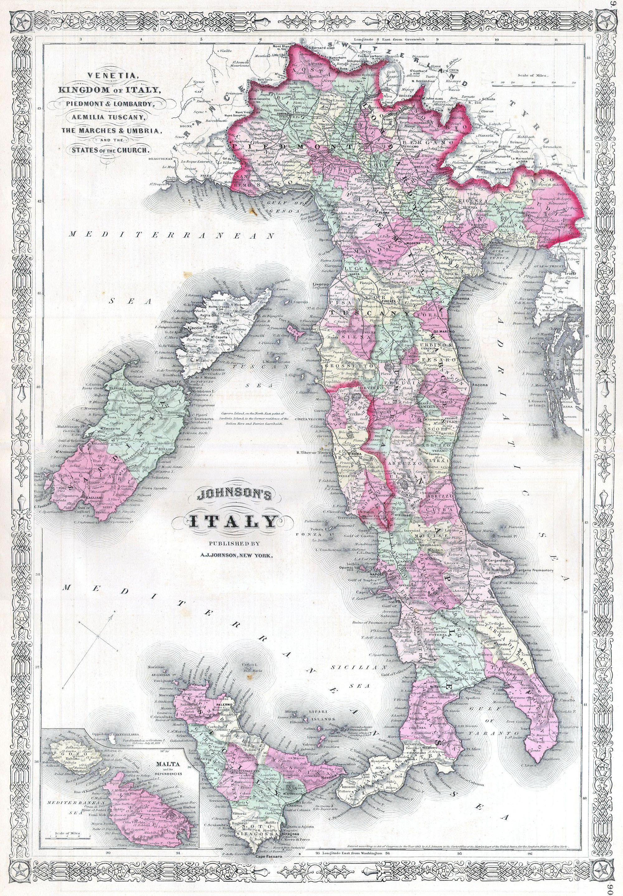 | 2 000 × 2 878 (5,57 MB) | Buks Artis (Diskusija | devums) | * Itālijas karalistes karte. * Datējums: 1864. * Avots: Johnson. ''A. J., Johnson's New Illustrated (Steel Plate) Family Atlas of The World with Physical Geography, and with Descriptions Geographical, Statistical, and Historic including The Latest Feder |
- Šo failu nevar pārrakstīt.
Faila lietojums
Šajā lapā ir saite uz šo failu: